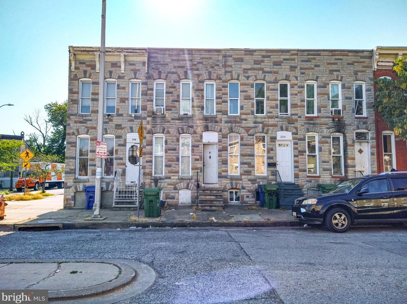
Purchase History
| Date | Event | Price | Source | Agents |
|---|---|---|---|---|
| 06/27/2006 | Sold | $30,000 | Public records |
Cost estimate history
| Year | Tax | Assessment | Market |
|---|---|---|---|
| 2014 | N/A | $60,000 | N/A |
| 2011 | $478 | N/A | $60,000 |
Market Activities
Building Permits
To date, we have no information about building permits in 2025
Nov 9, 2015
Description: Use as a single family dwelling
- Permit #: USE2015-04802
Mount St Fire Incident History
To date, we have no information about fire incidents in 2025
25 Jan 2019
Mobile property (vehicle) fire, other
Property Use —
Residential street, road or residential driveway
Area of Origin —
Engine area, running gear, wheel area
First Ignition —
Upholstered sofa, chair, vehicle seats
Heat Source —
Heat from powered equipment, other
22 Jun 2018
Building fires
Property Use —
1 or 2 family dwelling
Area of Origin —
Bedroom - < 5 persons; included are jail or prison
First Ignition —
Multiple items first ignited
Heat Source —
Arcing
21 May 2018
Passenger vehicle fire
Property Use —
Residential street, road or residential driveway
Area of Origin —
Engine area, running gear, wheel area
First Ignition —
Electrical wire, cable insulation
Heat Source —
Radiated, conducted heat from operating equipment
20 Apr 2018
Passenger vehicle fire
Property Use —
Street, other
Area of Origin —
Cargo/trunk area - all vehicles
First Ignition —
Box, carton, bag, basket, barrel
Heat Source —
Heat from other open flame or smoking materials
336 Mount St incidents registered in FEMA
(Federal Emergency Management Agency)
To date, we have no information about incidents registered in FEMA in 2025
09 Nov 2015
Hazardous condition, other
Property Use —
1 or 2 family dwelling
18 Oct 2015
Fuel burner/boiler malfunction, fire confined
Property Use —
Multifamily dwellings
Mt St Incidents registered in FEMA
(Federal Emergency Management Agency)
To date, we have no information about incidents registered in FEMA in 2025
24 Dec 2015
Attempted burning, illegal action, other
Property Use —
1 or 2 family dwelling
12 Dec 2015
Cooking fire, confined to container
Property Use —
Multifamily dwellings
12 Nov 2015
Attempted burning, illegal action, other
Property Use —
1 or 2 family dwelling
09 Nov 2015
Hazardous condition, other
Property Use —
1 or 2 family dwelling
Properties Nearby
| Street Address | Residens/Landlords | |
|---|---|---|
19 Mt St, Baltimore, MD Single Family Residential
|
Annette A Forrester | |
209 Mt St, Baltimore, MD 21223-3036 Single Family Residential
|
J Akbar, Gary Moore | |
222 Mt St, Baltimore, MD 21223-1718 Single Family Residential
|
J V Furley, Kathryn D Mcelgunn | |
234 Mt St, Baltimore, MD 21223-1718 Single Family Residential
|
Cheryl V Bivins, Raymond Gagne | |
312 Mt St, Baltimore, MD 21223-1720 Single Family Residential
|
Belchers Locke Key, Doris E Baesch | |
313 Mt St, Baltimore, MD 21223-1721 Single Family Residential
|
J Caprice, Hyman Gamerman | |
326 Mt St, Baltimore, MD 21223-1720 Single Family Residential
|
Ruby Brock, Robbin Fraley | |
514 Mt St, Baltimore, MD 21223-1238 Single Family Residential
|
George E Graves | |
532 Mt St, Baltimore, MD 21223-1238 Lot/Land
|
||
615 Mt St, Baltimore, MD 21217-2113 Single Family Residential
|
Irma D Bronson, Ivan N Bronson |
Schools near property
| Name | Type | Grade | Distance |
|---|---|---|---|
| Elementary school | |||
| Steuart Hill Academic Academy 30 South Gilmor St, Baltimore, MD 21223 410-396-1387 | Public | PK-8 | 0.25 |
| Samuel F. B. Morse Elementary School 424 South Pulaski St, Baltimore, MD 21223 410-396-1355 | Public | PK-5 | 0.38 |
| Middle school | |||
| Lansdowne Middle School 2400 Lansdowne Rd, Baltimore, MD 21227 410-887-1411 | Public | 6-8 | 2.35 |
| Arbutus Middle School 5525 Shelbourne Rd, Baltimore, MD 21227 410-887-1402 | Public | 6-8 | 4.08 |
| High school | |||
| Edmondson-Westside High School 501 North Athol Ave, Baltimore, MD 21229 410-396-0685 | Public | 9-12 | 2.42 |
| Lansdowne High & Academy Of Finance 3800 Hollins Ferry Rd, Baltimore, MD 21227 410-887-1415 | Public | 9-12 | 2.72 |